User:Hellerick
| Babel user information | ||||
|---|---|---|---|---|
| ||||
| Users by language |
| Babel user information | |||||||||
|---|---|---|---|---|---|---|---|---|---|
| |||||||||
| Users by language | |||||||||
Gallery of my files[edit]
Maps[edit]
-

Map of Kievan Rus in Spanish
-
.svg/111px-Kievan_Rus_in_1237_(ru).svg.png)
Map of Kievan Rus in Russian
-

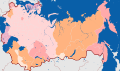
Map of Russian regions belonging to Siberia
-
.svg/120px-Subdivisions_of_Russia_in_1708_(ru).svg.png)
Subdivisions of the Tsardom of Russia in 1708
-
Subdivisions of the Russian Empire in 1914
-

Subdivisions of Mexico (in Russian)
-
Administrative subdivisions of Krasnoyarsk
-
Soviet Caucasus in 1957-1991
-
Ob-Yenisei Canal
-

Map of the regions of Russia with their postal codes
-
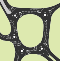
The Magic Roundabout (officially known as the Greenstead Roundabout) in Colchester
-

Map of the Extreme North territories (Russia)
-

Map of the Smaller Road of Life (WWII)
-

Siege of Leningrad, September 21, 1941
-
.svg/113px-WWII_-_The_War_of_Lines_(RU).svg.png)
WWII: Two Lines War (1940)
-

The Metropolitan Green Belt among the green belts of England
-

"Coloring book" map of Ocenia
-

Tibet according to different claims
-
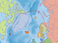
Arctic voyage of the submarine K-524
-

Map of the world in Soviet-like color-scheme
-

The Pennines
-
.svg/120px-Philippines_location_map_(square).svg.png)
Philippines location map
-
.svg/120px-Philippines_relief_location_map_(square).svg.png)
Philippines location map
-

Central Russia
-

United Deep Waterway System of European Russia
-

Hernán Cortés' possessions in Mexico
-
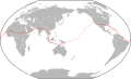
Amelia Earhart flight route
-

Greek state alliances in 362 BCE
-

Blank map for the northern river reversal
-

Ice Age glacial lakes of Siberia and Central Asia
-

Constituent entities of the Federation of South Arabia
-
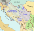
Yugoslavia under Axis occupation in 1941-1943
-

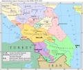
Location map of Transcaucasia
-
Location map of the Siberian Federal District (political)
-
Location map of the Siberian Federal District (physical)
-

Location map of the Urals Federal District (political)
-

Location map of the Urals Federal District (physical)
-

Location map of the North Caucasian Federal District (political)
-

Location map of the North Caucasian Federal District (physical)
-
Location map of the Southern Federal District (political)
-

Location map of the Southern Federal District (physical)
-

Soviet Union location map (1980s)
-
.svg/120px-Soviet_Union_location_map_(no_rivers).svg.png)
Soviet Union location map (1980s, no rivers)
-
.svg/120px-Soviet_Union_location_map_(1937).svg.png)
Soviet Union location map (1937)
-
.svg/120px-Soviet_Union_location_map_(1937%2C_no_rivers).svg.png)
Soviet Union location map (1937, no rivers)
-
.svg/120px-1937_world_map_(Winkel_tripel_projection).svg.png)
The world as of 1937
-

Blank topographic map of the British Isles
-

Blank political map of the Caucasus in 1903.
-

Maria Island, Tasmania.
-

Krasnoyarsk metro as planned in the 1990s
-

River Derwent at Hobart, Tasmania
-

The route of the ship Zarya, and the rescue party lead by Kolchak (1901-1902)
-

The Russian Polar Expedition of 1900-1902.
-
.svg/120px-Crimean_Federal_District_(numbered).svg.png)
Crimean Federal District
-

Map of Aleksandr Kolchak's attempt to save Eduard von Toll.
-
.svg/120px-Soviet_Union_location_map_(provinces).svg.png)
Soviet Union location map (1980s, oblast-level division)
-

Soviet Union subdivisions by type
-

Map of Southern Russia
-

Old City of Jerusalem blank map
-

Map of the Roman Empire during the First Tetrarchy.
-

Physical location map of Eurasia.
-

Political location map of Eurasia.
-
Maya civilization
-

Yaxchilán
-

Derwent River basin (Tasmania)
-

Mayan trade routes
-

Lenné Triangle, Berlin during the Cold War
-
.svg/114px-Steinstücken_Cold_War_map_(ru).svg.png)
Steinstücken during the Cold War
-

Jersey Shore shark attacks (1916)
-

Russian Black Sea coast
-

Railways of Moscow Oblast
-
Railways of Moscow
-
West Ukrainian People's Republic
-

Provinces of Prussia in 1806
-
.svg/120px-Map_of_Groznenskaya_Oblast_(1949).svg.png)
Groznenskaya Oblast in 1949
-

Solar Neighborhood
-
Greater Bashkiria in 1922
-
Counties of Pomerania in 1939
-
.svg/90px-Mariana_Trench_location_map_(RU).svg.png)
Mariana Trench location
-
.svg/120px-North-South_Transport_Corridor_map_(RU).svg.png)
North-South Transport Corridor
-
1917-1928 Soviet Ukraine borders formation
-
.svg/120px-Central_Chernozem_Oblast_administrative_division_map_(1930).svg.png)
Administrative division of Central Chernozem Oblast in 1930
-

Zimnyaya Vishnya fire scheme
-
Smaller Bashkiria in 1919
-
Appellation court districts of Russia
-

Cassation court districts of Russia
-

Arbitration appeal court districts of Russia
-
.svg/120px-Map_of_the_national_state_delimitation_of_the_republics_of_Central_Asia_(1924-1925).svg.png)
National state delimitation of Central Asia (1924-1925)
-

North-Eastern Rus principalities (13th century)
-

North-Eastern Rus principalities (14th century)
-

Scheme of Sebastopolis Octogon

.svg)

.svg)


.svg)


.svg)
.svg)


.svg)
.svg)
.svg)
.svg)


.svg)

.svg)


.svg)


.svg)


.svg)
.svg)

.svg)


.svg)


Cartography[edit]
-
-
-

-

-

-

Map of the world made in my own projection
-

Another map projection invented by me
-

A physical map in a version of this projection (1).
-

A physical map in a version of this projection (2).
-

Gauss Krueger map zones on globe
-

Gauss Krueger map zones on flat surface
-

Grid of World Map 1:2,500,000 sheets


Coats of arms[edit]
-

Krasnoyarskiy Kray
-

Arkhangelskaya Oblast
-
_(vector).svg/86px-Coat_of_Arms_of_Divnogorsk_(Krasnoyarsk_krai)_(vector).svg.png)
Divnogorsk
-

Kemerovo
-

Mari El
-

Volgogradskaya Oblast
-

Kurskaya Oblast
-

Jewish Autonomous Oblast
-

Kurganskaya Oblast
-

Nenetskiy Autonomous Okrug
-
.svg/89px-Coat_of_arms_of_Oryol_Oblast_(large).svg.png)
Orlovskaya Oblast
-

Igarka
-

Yalta
-

Dyatlovichi
-

Schärding
-

Braunau am Inn
-

Ried im Innkreis
-

Divnogorsk (2020), hatched
-

Divnogorsk (2020), without crown
-
Divnogorsk (2020), crowned


_(vector).svg)


.svg)


Scanned badges[edit]
-

Soviet-time COA of Chelyabinsk
-

Soviet-time COA of Divnogorgsk
-

Soviet-time COA of Divnogorsk
-

Soviet-time COA of Yeysk
-

Soviet-time COA of Yeysk
Emblems and logos[edit]
-

Prince Vladimir's seal
-

Drug Enforcement Administration logo
-

Russia 1 TV channel logo
-

Russian military roundel
-

Russian police roundel
-

Benelux star
-

East Slavic cube
-

DR3 channel
-

East Germany
-
Turkistan Legion
-

WikiProject Scouting Japan
-

Cross of Novgorod
-

Transnistrian ruble sign
-

Rotor FC banner
-
Uzbekistan football project
-

International Organization of Journalists


Flags[edit]
-

Krasnoyarskiy Kray
-

Volgogradskaya Oblast
-

Krasnodarskiy Kray
-
Permskaya Oblast
-

Belgorodskaya Oblast
-

Irkutskaya Oblast
-

US UK flags blending
-

Block of flags of Serbia, UK, Spain, and Russia
-

My Australian flag proposal
-

Río Negro Province (Argentina)
-

Mari El
-

Possible 52-star US flag
-

Turkic Council
-

Kurskaya Oblast
-
Fictional flag of the United Socialist States of America (deleted)
-
City of Yalta (2005-2015)
-

City of Yalta
-

City of Vorkuta
-

Solar eclipse flag for the Earth
-
Friuli-Venezia Giulia
-
Ilovlinskiy Rayon
-

Lingua Franca Nova (2004)
-

Lingua Franca Nova (2008)
-
.svg/120px-Flag_of_Radishchev_(2019-09).svg.png)
Radishchev
-

Divnogorsk (2020)
-

Great River flag of Mississippi


.svg)


Miscellaneous[edit]
-
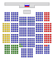
The seats in the State Duma of Russia in 2007
-

The seats in the State Duma of Russia in 2011
-
The seats in the State Duma of Russia in 2016
-

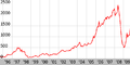
MICEX Index graph
-
RTSI graph
-

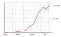
International reserve of the Russian Federation
-
Krasnoyarsk population graph
-

Egyptian license plate for tourist busses
-
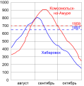
The Amur River level during the flood of 2013.
-

Former Soviet standard for paper formats.
-
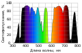
Neodymium glass transmission spectrum.
-

Diagram of true and visible horizon.
-
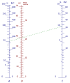
Struysky Earth curvature nomograph.
-

Natural landmark placeholder image.
-
.svg/120px-Dohyou_scheme_(RU).svg.png)
Dohyo for sumo
-

Consonants of the Russian linguistic alphabet
-
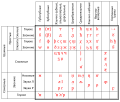
Vowels of the Russian linguistic alphabet
-

Bosnian Cyrillic alphabet
-

Kazakh Latin alphabet table (2018)
-

Kazakh Latin alphabet table (2021)
-

Magomed Shatayev's signature


.svg)


.svg)
Metro charts symbols: